Remote sensing and GIS-based mining prospection of Fe-Mn-Pb oxide mineralisation at Jbel Skindis (Eastern High Atlas, Morocco)
DOI:
https://doi.org/10.3989/egeol.44641.614Keywords:
Remote sensing, Fe-Mn-Pb deposits, Multicriteria analysis, Mineral exploration, Eastern High-AtlasAbstract
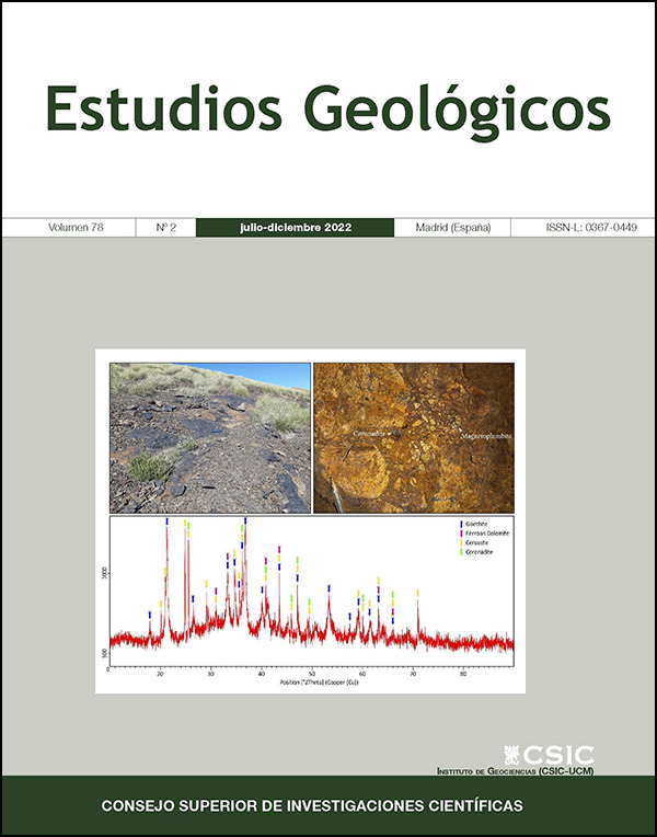
In recent years, remote sensing has had a prominent place in mineral exploration programs given its potential to identify alteration minerals, such as clay and hydroxyl minerals. Those minerals represent significant guides to mineral deposits considering their potential to host valuable concentrations of base metal elements. This work focuses on Fe-Mn-Pb mineral deposits within the Jbel Skindis area as a case study to illustrate the application of remote sensing images and GIS systems to highlight prospective zones and to extract information on ore-controlling factors using image enhancement and integration methods. Field observations and XRD data showed that the main remotely sensed alteration anomalies are characterized by oxides and hydroxides. Based on those indicative minerals, a mapping using Aster L1T and Landsat 8 OLI data was done: the 5/4 ratio highlighted gossans zones and the RGB combination (4/6, 2/1, 3/2) accentuates the hydrothermally altered areas. The lineament map extracted from Sentinel 2A and Landsat imagery allowed the reconstitution of the megafracture network that affected the region. The multi-criteria analysis of these satellite-derived data along with available geological data outcomes to delineate prospective zones in the study area, were found to be in highly fractured areas developing gossans and Fe rich alteration. Verified via field survey, this approach was successfully applied to the Jbel Skindis area to rapidly delineate oxidized ore outcrops. This provides a remote sensing model for future prospecting efforts for similar mineral deposits both in the Eastern High-Atlas province and in other similar areas.
Downloads
References
Atapour, H. & Aftabi, A. (2007). The geochemistry of gossans associated with Sarcheshmeh porphyry copper deposit, Rafsanjan, Kerman, Iran: Implications for exploration and the environment. Journal of Geochemical Exploration, 93: 47-65. https://doi.org/10.1016/j.gexplo.2006.07.007
Başıbüyük, Z. & Ekdur, E. (2018). Determination of iron minerals with landsat ETM, Kırşehir, Turkey. Gospodarka Surowcami Mineralnymi, 34: 23-36.
Benaissi, L.; Amraoui, T.; Tobi, A.; Ibouh, H.; Zaid, K.; Elamari, K. & Hibti. M. (2022). Geological mapping and mining prospecting in the Aouli inlier (Eastern Meseta, Morocco) based on remote sensing and geographic information systems (GIS). China Geology. https://doi.org/10.31035/cg2022035
Bouabdellah, M. & Sangster, D. (2016). Geology, Geochemistry, and Current Genetic Models for Major Mississippi Valley-Type Pb-Zn Deposits of Morocco. In: Mineral Deposits of North Africa (Bouabdellah, M. & Slack, J.). Mineral Resource Reviews, Springer, Cham, 463-495. https://doi.org/10.1007/978-3-319-31733-5_19
Bouchta, R. (1967). Étude géologique et micropaléontologique au Jbel Mechkakour (Haut Atlas oriental). PhD Thesis, Faculty of Sciences, Paris, 99 pp.
Caïa, J. (1969). Les minéralisations plombo-cupro-zincifères stratiformes de la région des plis marginaux du Haut Atlas oriental: un exemple de relations entre des minéralisations et une sédimentation détritique continentale: Maroc. Service Géologique Notes, 29: 107-120.
Caïa, J. (1976). Paleogeographical and Sedimentological Controls of Copper, Lead, and Zinc Mineralizations in the Lower Cretaceous Sandstones of Africa. Bulletin of the Society of Economic Geologists, 71: 409-422. https://doi.org/10.2113/gsecongeo.71.2.409
Choulet, F.; Charles, N.; Barbanson, L.; Branquet, Y.; Sizaret, S.; Ennaciri, A. & Chen, Y. (2014). Non-sulfide zinc deposits of the Moroccan High Atlas: multi-scale characterization and origin. Ore Geology Reviews, 56: 115-140. https://doi.org/10.1016/j.oregeorev.2013.08.015
Dresnay, R. (1963). La stratigraphie du Jbel Mechkakour (Hauts-Plateaux du Maroc oriental). Compte rendu sommaire des Séances de la Société géologique de France, Paris, fasc, 7: 238-240.
Drusch, M.; Del Bello, U.; Carlier, S.; Colin, O.; Fernandez, V.; Gascon, F.; Hoersch, B.; Isola, C.; Laberinti, P.; Martimort, P.; Meygret, A.; Spoto, F.; Marchese, O.S.F. & Bargellini, P. (2012). Sentinel 2: ESA's Optical High-Resolution Mission for GMES Operational Services. Remote Sensing of Environment, 120: 25-36. https://doi.org/10.1016/j.rse.2011.11.026
Duda, K.; Daucsavage, J.; Siemonsma, D.; Brooks, B.; Oleson, R.; Meyer, D. & Doescher, C. (2015). Advanced spaceborne thermal emission and reflection radiometer (aster) level 1 precision terrain corrected registered at-sensor radiance product (ast_l1t). US Geol Surv, USA.
El-Sawy, E.K.; Atef, M.I.; El-Bastawesy, A.M. & El-Saud, A.W. (2016). Automated, manual lineaments extraction and geospatial analysis for Cairo-Suez district (North-eastern Cairo-Egypt), using remote sensing and GIS. International Journal of Innovative Science, Engineering & Technology, 3(5): 491-500.
Emberger, A. (1965). Caractères polygénétiques des minéralisations plombifères de la Haute Moulouya (gisements d'Aouli, Mibladen et Zeïda, Maroc). Comptes Rendus Academie Sciences Paris (a), 260(9): 3433-3436.
ERDAS (Firm). (2007). ERDAS Field Guide. Leica Geosystems GIS & Mapping, LLC. Norcross. 378 pp.
Es-sabbar, B.; Essalhi, M.; Essalhi, A. & Si Mhamdi, H. (2020). Lithological and Structural Lineament Mapping from Landsat 8 OLI Images in Ras Kammouna Arid Area (Eastern Anti-Atlas, Morocco). Economic and Environmental Geology, 4: 425-440.
Essalhi, M.; Sizaret, S.; Barbanson, L.; Chen, Y.; Lagroix, F.; Demory, F.; Nieto, J.M.; Sáez, R. & Capitán, M.A. (2011). A case study of the internal structures of gossans and weathering processes in the Iberian Pyrite Belt using magnetic fabrics and paleomagnetic dating. Mineralium Deposita, 46: 981-999. https://doi.org/10.1007/s00126-011-0361-8
Ghorbani, A.; Honarmand, M.; Shahriari, H. & Hassani, M.J . (2019). Regional scale prospecting for non-sulphide zinc deposits using ASTER data and different spectral processing methods. International Journal of Remote Sensing, 40(23): 8647-8667. https://doi.org/10.1080/01431161.2019.1620372
Haddoumi, H. (1998). Les formations détritiques «couches rouges» (Bathonien et Crétacé inférieur) de la région d'Anoual (Haut Atlas oriental, Maroc): sédimentologie, stratigraphie et paléogéographie. PhD Thesis, Mohammed 1st University, Oujda, 229 pp.
Haddoumi, H.; Baidder, L.; Karim, M.; Kaoukaya, A.; Soulaimani, A.; Ouanaimi, H.; Amhoud, H.; Boudad , L.; Eddebbi, A.; Hilali, M.; Badra, L.; Mahmoudi, A.; El Arabi, E.H. & Allouban, M. (2018). Carte géologique du Maroc (1/50.000), Feuille Mazzer. Notes et Mémoires Serv. Géol. Maroc, 596.
Haddoumi, H.; Baidder, L.; Karim, M.; Ouanaimi, H.; Soulaimani, A.; Aria, E.H.; Kaoukaya, A.; Ettachfini, E.M.; Hafid, A.; Boudad , L.; Amhoud, H.; El Arabi, E.H.; Eddebbi, A.; Hilali, M. & Chibani, B. (2019). Carte géologique de Maroc (1/50 000), feuille de Talsint Ouest. Notes et Mémoires, Service Géologique Maroc, 607.
Hung, L.Q.; Batelaan, O. & De Smedt, F. (2005). Lineament extraction and analysis, comparison of Landsat ETM and Aster imagery. Case study: Suoimuoi tropical karst catchment. Vietnam. Proceedings SPIE 5983, Remote Sensing for Environmental Monitoring, GIS Applications and Geology V, Bruges, Belgium, 182-193. https://doi.org/10.1117/12.627699
Ibrahim, U. & Mutua, F. (2014). Lineament extraction using landsat 8 (OLI) in Gedo. Somalia. International Journal of Science and Research, 3(9): 291-296.
Ihlen, V. (2019). Landsat 8 (L8) Data Users Handbook, U.S. Geological Survey, LSDS-1574 Version 5.0, Ed.; USGS: EROS, Sioux Falls, South Dakota, 106 pp.
Jébrak, M. (2008). Géologie des ressources minérales. Ministère des Ressources Naturalles et de la Faune, Denis L. Lefebvre, 673pp.
Khunsa, F.; Ur Rehman, A.; Khattak, U.; Kausar, A.; Toqeer, M. & Haider, N. (2017). Minerals identification and mapping using ASTER satellite image. Journal of Applied Remote Sensing, 11(4): 046006. https://doi.org/10.1117/1.JRS.11.046006
Koçal, A.; Duzgun, H.S. & Karpuz, C. (2004). Discontinuity mapping with automatic lineament extraction from high resolution satellite imagery. ISPRS XX, Istanbul, 12-23.
Mancino, G.; Ferrara, A.; Padula, A.; Nolè, A. (2020). Cross-Comparison between Landsat 8 (OLI) and Landsat 7 (ETM+) Derived Vegetation Indices in a Mediterranean Environment. Remote Sens, 12: 291. https://doi.org/10.3390/rs12020291
Mattauer, M.; Tapponier, P. & Proust F. (1977). Sur les mécanismes de formation des chaînes intracontinentales. L'exemple des chaînes atlasiques du Maroc. Bulletin de la Société géologique de France, 7: 521-526. https://doi.org/10.2113/gssgfbull.S7-XIX.3.521
Molan, Y.E. & Behnia, P. (2013). Prospectivity mapping of Pb-Zn SEDEX mineralization using remote-sensing data in the Behabad area, Central Iran. International Journal of Remote Sensing, 34(4): 1164-1179. https://doi.org/10.1080/01431161.2012.718460
Mouguina, E.M. (2004). Les minéralisations polymétalliques (Zn-Pb, Cu, Co, Ni) du Jurassique du Haut Atlas central (Maroc) : Contexte géodynamique, typologies et modèles génétiques. PhD Thesis, Faculty of Sciences, Marrakech, 320 pp.
Piqué, A. & Michard, A. (1989). Moroccan Hercynides: a synopsis. The Paleozoic sedimentary and tectonic evolution at the northern margin of West Africa. American Journal of Science, 289: 286-330. https://doi.org/10.2475/ajs.289.3.286
Pour, A.B.; Hashim, M. & Marghany, M. (2010). Characterization of ASTER Data for Mineral Exploration. Proceedings of the MRSS 6th international remote sensing & GIS conference and exhibition, Kuala Lumpur, Malaysia, 6.
Prost, G.L. (2013). Remote sensing for geoscientists. Third Edition (3rd Ed.). CRC Press. https://doi.org/10.1201/b15638
Rajendran, S.; Thirunavukkarasu, A.; Balamurugan, G. & Shankar, K. (2011). Discrimination of iron ore deposits of granulite terrain of Southern Peninsular India using ASTER data. Journal of Asian Earth Sciences, 41(1): 99-106. https://doi.org/10.1016/j.jseaes.2011.01.004
Rouvier, H.; Perthuisot, V. & Mansouri, A. (1985). Pb-Zn deposits and salt-bearing diapirs in Southern Europe and North Africa. Economic Geology, 80(3): 666-687. https://doi.org/10.2113/gsecongeo.80.3.666
Roy, D.; Wulder, M.; Loveland, T.; Woodcock, C.; Allen, R.; Anderson, M.; Helder, D.; Irons, J.; Johnson, D.; Kennedy, R.; Scambos, T.; Schaaf, C.; Schott, J.; Sheng, Y.; Vermote, E.; Belward, A.; Bindschadler, R.; Cohen, W.; Gao, F.; Hipple, J.; Hostert, P.; Huntington, J.; Justice, C.; Kilic, A.; Kovalsky, V.; Lee, Z.; Lymburner, L.; Masek, J.; McCorkel, J.; Shuai, Y.; Trezza, R.; Vogelmann, J.; Wynne, R. & Zhu, Z. (2014). Landsat-8: Science and product vision for terrestrial global change research. Remote Sensing of Environment, 145: 154-172. https://doi.org/10.1016/j.rse.2014.02.001
Sarp, G. & Toprak, V. (2007). Spatial analysis of lineaments, north-west of Ankara. 28th Asian Conference on Remote Sensing, ACRS, 3.
Scanvic J. 1993. Télédétection aérospatiale et informations géologiques. BRGM Manuels et méthodes, Orleans, 284 pp.
Sekandari, M.; Masoumi, I.; Muslim, A.; Rahmani, O.; Hashim, M.; Zoheir, B.; Pradhan, B.; Misra, A. & Aminpour, S. (2020). Application of Landsat-8, Sentinel-2, ASTER and WorldView-3 Spectral Imagery for Exploration of Carbonate-Hosted Pb-Zn Deposits in the Central Iranian Terrane (CIT). Remote Sensing, 12(8): 1239. https://doi.org/10.3390/rs12081239
Singh, A. & Harrison, A. (1985). Standardized principal components. International Journal of Remote Sensing, 6: 883-896. https://doi.org/10.1080/01431168508948511
Traore, M.; Çan, T. & Tekin, S. (2022). Mapping carbonate-hosted Pb-Zn mineralization zones in Yahyali Province (Eastern Taurus-Turkey) using ASTER data. Advances in Space Research, 69(1): 266-281. https://doi.org/10.1016/j.asr.2021.07.034
Yang, M.; Ren, G.; Han, L.; Yi, H. & Gao, T. (2018). Detection of Pb-Zn mineralization zones in west Kunlun using Landsat 8 and ASTER remote sensing data. Journal of Applied Remote Sensing, 12(2): 18-26. https://doi.org/10.1117/1.JRS.12.026018
Younis, M.T.; Gilabert, M.A.; Melia, J. & Bastida, J. (1997). Weathering process effects on spectral reflectance of rocks in a semi-arid environment. International Journal of Remote Sensing, 18(16): 3361-3377. https://doi.org/10.1080/014311697216928
Published
How to Cite
Issue
Section
License
Copyright (c) 2022 Consejo Superior de Investigaciones Científicas (CSIC)

This work is licensed under a Creative Commons Attribution 4.0 International License.
© CSIC. Manuscripts published in both the print and online versions of this journal are the property of the Consejo Superior de Investigaciones Científicas, and quoting this source is a requirement for any partial or full reproduction.
All contents of this electronic edition, except where otherwise noted, are distributed under a Creative Commons Attribution 4.0 International (CC BY 4.0) licence. You may read the basic information and the legal text of the licence. The indication of the CC BY 4.0 licence must be expressly stated in this way when necessary.
Self-archiving in repositories, personal webpages or similar, of any version other than the final version of the work produced by the publisher, is not allowed.