Deep structure in the Bir M’Chergua region (North-East of Tunisia). Hydrogeological implications
DOI:
https://doi.org/10.3989/egeol.42955.461Keywords:
Tunisia, Bir M’Chergua, deep structures, hydrogeological scheme, gravimetryAbstract
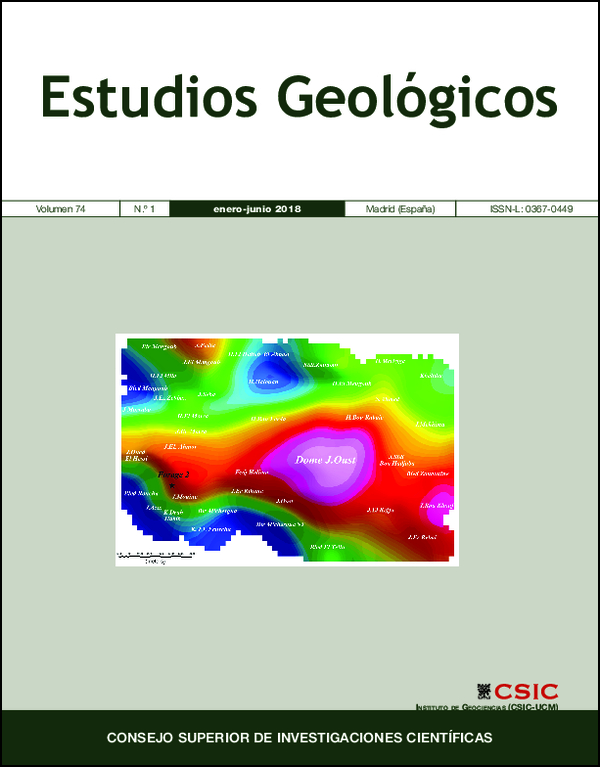
The Bir M’Chergua region, located fifty kilometers from the capital Tunis, is an important economic pole in Tunisia. However, the water shortage resulting from many successive drought periods has led to a significant degradation of the various industrial, tourist and agricultural activities in this region. Groundwater exploitation can alleviate this situation, but it requires a better characterization of aquifers. In this context, the present study aims to provide precisions on the Bir M’Chergua hydrogeological scheme by determining the subsurface structures from gravimetric data interpretation. Residual anomaly, vertical derivative and total horizontal gradient maps are calculated from the Bouguer anomaly to identify and delimit the causative sources. The Euler deconvolution technique is also applied to estimate these sources depth. The structural map resulting from gravimetric interpretation highlights buried structures and discontinuities of different direction and depth that can greatly influence the Bir M’Chergua aquifer system geometry and functioning. In fact, the highlighting of tectonic features at more than 1500 m depth around the Jebel Oust dome explains the origin and the high salinity of the thermal waters in this sector; such tectonic accidents have favored a deep penetration of the recharge water as well as their contact with the Triassic terrains.
Downloads
References
Amiri, A.; Chaqui, A.; Hamdi Nasr, I.; Inoubli, M.H.; Ben Ayed, N. & Tlig, S. (2011). Role of preexisting faults in the geodynamic evolution of northern Tunisia, insights from gravity data from the Medjerda valley. Tectonophysics, 506: 1–11. https://doi.org/10.1016/j.tecto.2011.03.004
Bajanik, S.; Biely, A.; Mencik, E.; Salaj, J. & Stranik, Z. (1977). Notice explicative de la carte géologique 1/50.000 de Zaghouan. Service géologique de la Tunisie.
Benassi, R.; Jallouli, C.; Hammami, M. & Turki, M.M. (2006). The structure of Jebel El Mourra, Tunisia: a diapiric structure causing a positive gravity anomaly. Terra Nova, 18: 432–439. https://doi.org/10.1111/j.1365-3121.2006.00709.x
Ben Ayed, N. & Viguier, C. (1981). Interprétation structurale de la Tunisie atlasique. Comptes Rendus de l'Académie des Sciences, 292: 5–20.
Ben Chelbi, M.; Melki, F. & Zargouni, F. (2008). Précision sur l'évolution structurale de l'Atlas 467 septentrional de Tunisie depuis le Crétacé (Bassin de Bir M'Cherga). Echos d'une 468 évolution polyphasée de la marge tunisienne dans son cadre méditerranéen. Africa Geosciences Review, 3: 229–246.
Blakely, R.J. (1996). Potential Theory in Gravity and Magnetic Applications. Cambridge University Press, 461 pp.
Bouaziz, S.; Barrier, E.; Soussi, M.; Turki, M.M. & Zouari, H. (2002). Tectonic evolution of the northern African margin in Tunisia from paleostress data and sedimentary record. Tectonophysics, 337: 227–253. https://doi.org/10.1016/S0040-1951(02)00370-0
Buness, H.; Giese, P.; Bobier, C.; Eva, C.; Merlanti, F.; Pedone, R.; Jenatton, L.; Nguyen, D.T.; Thouvenot, F.; Egloff, F.; Makris, J.; Lozej, A.; Maistrello, M.; Scarascia, S.; Tabacco, I.; Burollet, P.F.; Morelli, C.; Nicolich, R.; Zaghouani, T.; Egger, A.; Freeman, R. & Mueller, S. (1992). The EGT'85 seismic experiment in Tunisia. A reconnaissance of the deep structures. Tectonophysics, 207: 245–267. https://doi.org/10.1016/0040-1951(92)90479-P
Castany, G. (1951). Etude géologique de l'Atlas tunisien oriental. Thèse es-Sciences France. Annales de Mines et de la Géologie n°8, Tunisie, 632 pp.
Chihi, L. (1988). Déformations tectoniques quaternaires en Tunisie centrale (région de Kasserine). Géologie Méditerranéenne, 3: 177–182.
Dubois, J.; Diament, M. & Cogne, J.P. (2011). Géophysique. Cours et exercices corrigées, 4ème édition. Dunod, Paris, 257 pp.
El Goumi, N.; Jaffal, M.; Kchikach, A. & Manar, A. (2010). Apport de la gravimétrie à l'étude de la structure du bassin du Haouz (Maroc). Estudios Geologicos, 66: 181–191. https://doi.org/10.3989/egeol.40051.082
Fedi, M. & Florio, G. (2001). Detection of potential fields source boundaries by enhanced horizontal derivative method. Geophysical prospecting, 49: 40–58. https://doi.org/10.1046/j.1365-2478.2001.00235.x
Gabalda, G.; Bonvalota, B.S. & Hipkin, R. (2003). CG3TOOL; an interactive computer program to process Scintrex CG-3/3M gravity data for high–resolution applications. Computers & Geosciences, 29: 155–171. https://doi.org/10.1016/S0098-3004(02)00114-0
Hamdi Nasr, I.; Inoubli, M.H.; Ben salem, A.; Tlig, S. & Mansouri, A. (2009). Gravity contributions to the understanding of salt tectonics from the Jebel Cheid area (dome zone, Northern Tunisia). Geophysical Prospecting, 57: 719–728. https://doi.org/10.1111/j.1365-2478.2009.00788.x
Inoubli, M.H. & Mansouri, A. (2006). Apport de la gravimétrie dans la caractérisation des modèles de mise en place des structures triasiques à caractère extrusif. 21ème Colloque Africain de Géologie, Maputo, Mozambique. PMid:16831013
Jacobsen, B.H. (1987). A case for upward continuation as a standard separation filter for potential field maps. Geophysics, 52: 1138–1148. https://doi.org/10.1190/1.1442378
Jacoby, W. & Smilde, P. L. (2009). Gravity Interpretation, Fundamentals and Application of Gravity Inversion and Geological Interpretation. Springer, Heidelberg, 395 pp.
Jallouli, C. & Mickus, K. (2000). Regional gravity analysis of the crustal structure of Tunisia. Journal of African Earth Sciences, 30: 63–78. https://doi.org/10.1016/S0899-5362(00)00008-7
Jauzein, A. (1957). Carte géologique de Bir M'Cherga à l'échelle 1:50000. Service Géologique de Tunisie.
Jauzein, A. (1957). Notice explicative de la carte géologique de Bir M'Cherga à l'échelle 1:50000. Service Géologique de Tunisie.
Kadri, A. & Ben Haj Ali, M. (1999). Eléments de réflexion sur les linéaments tectoniques Est-Ouest et Nord-Sud et les grabens associés en Tunisie septentrionale: Notes du service géologique de Tunisie, 65: 131–140.
Morgan, M.; Grocott, J. & Moody, R. (1998). The structural evolution of the Zaghouan–Ressas Structural Belt, northern Tunisia. Geological Society London, 132: 405–422. https://doi.org/10.1144/GSL.SP.1998.132.01.23
Mzali, H. & Zouari, H. (2006). Caractérisation géométrique et cinématique des structures liées aux phases compressives de l'Éocène au Quaternaire inférieur en Tunisie: exemple de la Tunisie nord-orientale. Comptes Rendus de l'Académie des Sciences, 338: 742–749. https://doi.org/10.1016/j.crte.2006.05.003
Najine, A.; Jaffal, M.; El Khammari, K.; Aïfa, T.; Khattach, D.; Himi, M.; Casas, A.; Badrane, S. & Aqil, H. (2006). Contribution de la gravimétrie à l'étude de la structure du bassin de Tadla (Maroc): Implications hydrogéologiques. Comptes Rendus de l'Académie des Sciences, 338: 676–682. https://doi.org/10.1016/j.crte.2006.04.015
Nely, G. (1986): Les séries à évaporites en exploration pétrolière. 2 méthodes géophysiques. Technip, Paris, 258 pp.
Ouerghi, S.; Rebai, N.; Gabtni, H.; Farhat, F. & Bouaziz, S. (2013). Apport de la gravimétrie à l'étude des structures effondrées du Nord-Est de la Tunisie: implications hydrogéologiques. Hydrological Sciences Journal, 58: 1–13. https://doi.org/10.1080/02626667.2013.818219
Prieto, C. (1996). Gravity/Magnetic signatures of variations geologic models exercise in parttern recognition. Integrated Geophysics Corporation. Footnote series, 4: 1–26.
Reid, A.B.; FitzGerald, D. & McInerney, P. (2003). Euler deconvolution of gravity data. 73rd Annual International Meeting, SEG, Expanded Abstracts, 576–579. https://doi.org/10.1190/1.1817993
Rolland, G. (1885). Sur la montagne et la grande faille de Zaghouan (Tunisie). Comptes Rendus de l'Académie des Sciences, 101: 1187–1190.
Sarsar Naouali, B.; Guellala, R.; Bey, S. & Inoubli, M.H. (2017). Gravity Data Contribution for Petroleum Exploration Domain: Mateur Case Study (Saliferous Province, Northern Tunisia). Arabian Journal for Science and Engineering, 42: 339–352. https://doi.org/10.1007/s13369-016-2152-0
Schoeffler, J. (1975). Gravimétrie appliquée aux recherches structurales et à la prospection pétrolière et minière. Technip, Paris, 288 pp. PMid:1098841
Solignac, M. (1927). Etude géologique de la Tunisie septentrionale. Thèse d'Etat, 756 pp.
Thompson, D.T. (1982). EULDPH: a new technique for making computer-assisted depth estimates from magnetic data. Geophysics, 47: 31–37. https://doi.org/10.1190/1.1441278
Turki, M.M. (1980). La "faille de Zaghouan" est la résultante de structures superposées (Atlas Tunisien Central). Bulletin de la Société Géologique de France, 3: 321–325. https://doi.org/10.2113/gssgfbull.S7-XXII.3.321
Turki, M.M. (1988). Polycinématique et contrôle sédimentaire associé sur la cicatrice Zaghouan-Nebhana. Thèse d'Etat, Université de Tunis, 252 pp.
Zeng, H.; Xu, D. & Tan, H. (2007). A model study for estimating optimum upward continuation height for gravity separation with application to a Bouguer gravity anomaly over a mineral deposit, Jilin province, northeast China. Geophysics, 72: 145–150. https://doi.org/10.1190/1.2719497
Published
How to Cite
Issue
Section
License
Copyright (c) 2018 Consejo Superior de Investigaciones Científicas (CSIC)

This work is licensed under a Creative Commons Attribution 4.0 International License.
© CSIC. Manuscripts published in both the print and online versions of this journal are the property of the Consejo Superior de Investigaciones Científicas, and quoting this source is a requirement for any partial or full reproduction.
All contents of this electronic edition, except where otherwise noted, are distributed under a Creative Commons Attribution 4.0 International (CC BY 4.0) licence. You may read the basic information and the legal text of the licence. The indication of the CC BY 4.0 licence must be expressly stated in this way when necessary.
Self-archiving in repositories, personal webpages or similar, of any version other than the final version of the work produced by the publisher, is not allowed.