Mapeo de redes de fracturas mediante imágenes Landsat-8 OLI en la zona minera de Jbel Tijekht en el Anti-Atlas oriental de Marruecos
DOI:
https://doi.org/10.3989/egeol.43887.587Palabras clave:
Cartografía estructural, Extracciones de lineamientos, Variscan, Jbel Tijekht, Dorsal Ougnat-Ouzina, Anti-Atlas oriental marroquíResumen
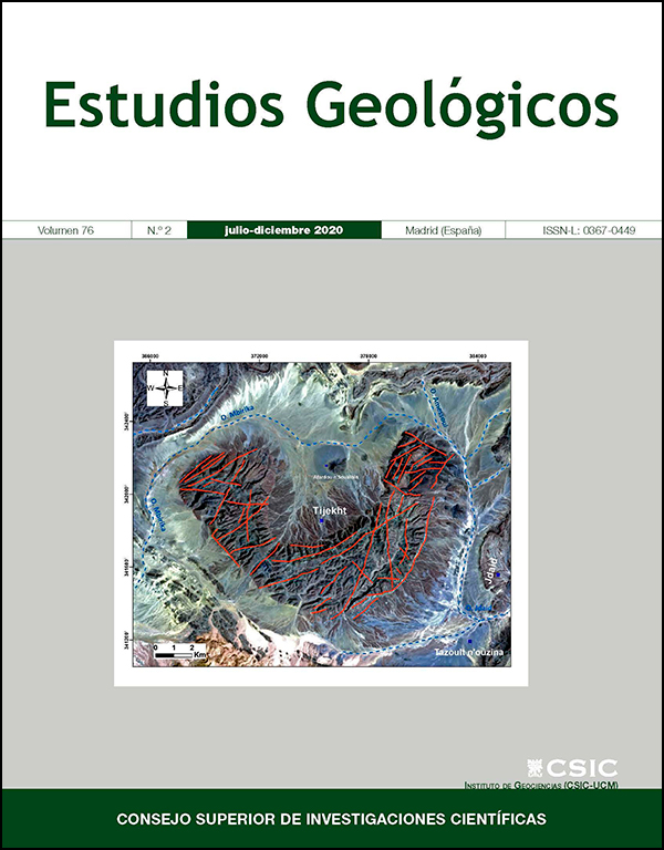
El Jbel Tijekht es una de las estructuras geológicas más importantes de la cordillera de Ougnat-Ouzina en el Anti-Atlas Oriental. Este macizo en forma de media luna fue afectado por una red de fracturas que es visible a diferentes escalas. Es particularmente rico en vetas mineralizadas de barita y está asociado con otros minerales (por ejemplo, pirita, calcopirita, esfalerita y galena). Para estudiar los sistemas de fracturas en la zona minera de Jbel Tijekht, optamos por una combinación de teledetección e investigación de campo que se convirtió en una importante herramienta para la cartografía de las fracturas y la exploración de minerales. Este trabajo presenta un enfoque metodológico para detectar los lineamientos estructurales. Para ello, se aplicaron diversas técnicas a la imagen del Landsat 8 para mejorar la visibilidad de las estructuras lineales. Tras correcciones radiométricas y atmosféricas, los colores compuestos y los filtros direccionales aplicados al componente principal (PC1) se pudo establecer un mapa de lineamientos para Jbel Tijekht. La validación y corrección de estos lineamientos se basan en documentos preexistentes combinados con observaciones de campo. El análisis estadístico del mapa de lineamientos permite la identificación de al menos tres sistemas de fractura direccional con orientaciones promedio NS, NE-SW y ENE-WSW. Los sistemas NS y NE-SW muestran una alta densidad en la mayor parte del área de estudio. Estos resultados claramente se superponen a diferentes estructuras tectónicas y a las vetas existentes. Esto permitió establecer un vínculo geológico entre la litología, los sistemas de fracturas y la mineralización. La densidad de fracturas puede atribuirse a las últimas fases de fragilidad del orógeno varisco, lo que refleja la reología de las unidades de roca; la alta densidad de fractura se observa en las rocas competentes como las areniscas de Tabanit. Estas zonas constituyen un área favorable para los depósitos de mineralización.
Descargas
Citas
Abdullah, A.; Nassr, S. & Ghaleeb, A. (2013). Landsat ETM-7 for lineament mapping using automatic extraction technique in the SW part of Taiz Area, Yemen. Global Journal of Human-Social Science Research, 13: 35-37. https://doi.org/10.1155/2013/201757
Abrams, M.J.; Brown, D.; Lepley, L. & Sadowski, R. (1983). Remote sensing for porphyry copper deposits in southern Arizona. Economic Geology, 78: 591- 604. https://doi.org/10.2113/gsecongeo.78.4.591
Adiri, Z.; El Harti, A.; Jellouli, A.; Lhissou, R.; Maacha, L.; Azmi, M.; Zouhair, M. & Bachaoui, E.M. (2017). Comparison of Landsat-8, ASTER and Sentinel 1 satellite remote sensing data in automatic lineaments extraction: A case study of Sidi Flah- Bouskour inlier, Moroccan Anti Atlas. Advances in Space Research, 60: 2355-2367. https://doi.org/10.1016/j.asr.2017.09.006
Adiri, Z.; El Harti, A.; Jellouli, A.; Maacha, L.; Azmi, M.; Zouhair, M. & Bachaoui, E.M. (2020). Mineralogical mapping using Landsat-8 OLI, Terra ASTER and Sentinel-2A multispectral data in Sidi Flah-Bouskour inlier, Moroccan Anti-Atlas. Journal of Spatial Science, 65(1): 147-171. https://doi.org/10.1080/14498596.2018.1490213
Adiri, Z.; El Harti, A.E.; Jellouli, A.; Maacha, L. & Bachaoui, E.M. (2016). Lithological mapping using Landsat 8 OLI and Terra ASTER multispectral data in the Bas Drâa inlier, Moroccan Anti Atlas. Journal of Applied Remote Sensing, 10: 016005. https://doi.org/10.1117/1.JRS.10.016005
Ahmad Irouhani, R.; Rahimi, B.; Karimpour, M.H.; Malekzadeh Shafaroudi, A.; Afshar Najafi, S. & Pour, A.B. (2017). Fracture mapping of lineaments and recognizing their tectonic significance using SPOT-5 satellite data: A case study from the Bajestan area, Lut Block, east of Iran. Journal of African Earth Sciences, 134: 600-612. https://doi.org/10.1016/j.jafrearsci.2017.07.027
Ait Daoud, M.; Essalhi, A.; Essalhi, M. & Toummite, A. (2020). The role of variscan shortening in the control of mineralization deposition in Tadaout-Tizi n'Rsas mining district (Eastern Anti-Atlas, Morocco). Bulletin of The Mineral Research and Exploration, 161(161): 1-10. https://doi.org/10.19111/bulletinofmre.524167
Álvaro, J.J.; Aretz, M.; Benharref, M.; Hibti, M.; Pouclet, A.; El Hadi, H.; Koukaya, A.; Ettachfini, E.M. & Boudad, L. (2014a). Carte géologique du Maroc au 1/50 000, feuille Tawz-Mémoire explicatif. Notes et Mémoires du Service Géologique du Maroc, 551.
Álvaro, J.J.; Benharref, M.; Hibti, M. & Boudad, L. (2014b). Carte géologique du Maroc au 1/50,000, feuille Irara. Notes et Mémoires du Service Géologique du Maroc, 552.
Amer, R.; Sultan, M.; Ripperdan, R. & Encarnación, J. (2012). Structural Architecture for Development of Marginal Extensional Sub-Basins in the Red Sea Active Rift Zone. International Journal of Geosciences, 03: 133-152. https://doi.org/10.4236/ijg.2012.31016
Anbalagan, R.; Kumar, R.; Lakshmanan, K.; Parida, S. & Neethu, S. (2015). Landslide hazard zonation mapping using frequency ratio and fuzzy logic approach, a case study of Lachung Valley, Sikkim. Geoenvironmental Disasters, 2: 6.
Argialas, M.; Mavrantza, O. & Stefouli, M. (2004). Automatic mapping of tectonic lineaments (faults) using methods and techniques of Photointerpretation / Digital Remote Sensing and Expert Systems, Thales project, 1174(6).
Baidder, L.; Michard, A.; Soulaimani, A.; Fekkak, A.; Eddebbi, A.; Rjimati, E.-C. & Raddi, Y. (2016). Fold interference pattern in thick-skinned tectonics; a case study from the external Variscan belt of Eastern Anti-Atlas, Morocco. Journal of African Earth Sciences, 119: 204-225. https://doi.org/10.1016/j.jafrearsci.2016.04.003
Baidder, L.; Raddi, Y.; Tahiri, M. & Michard, A. (2008). Devonian extension of the Pan-African crust north of the West African craton, and its bearing on the Variscan foreland deformation: evidence from eastern Anti-Atlas (Morocco). Geological Society, London, Special Publications, 297: 453-465. https://doi.org/10.1144/SP297.21
Benharref, M.; Álvaro, J.J.; Hibti, M.; Pouclet, A.; El Hadi, H. & Boudad, L. (2014a). Carte géologique du Maroc au 1/50 000, feuille Marzouga-Mémoire explicatif. Notes et Mémoires du Service Géologique du Maroc, 553.
Benharref, M.; Álvaro, J.J.; Hibti, M.; Pouclet, A.; El Hadi, H.; Koukaya, A. & Ettachfini, E.M. (2014b). Carte géologique du Maroc au 1/50 000, feuille Al Atrous-Mémoire explicatif. Notes et Mémoires du Service Géologique du Maroc, 555.
Benharref, M.; Hibti, M.; Pouclet, A.; El Hadi, H. & Koukaya, A. (2014c). Carte géologique du Maroc au 1/50 000, feuille Mfis-Mémoire explicatif. Notes et Mémoires du Service Géologique du Maroc, 554.
Chander, G.; Markham, B.L. & Helder, D.L. (2009). Summary of current radiometric calibration coefficients for Landsat MSS, TM, ETM+, and EO-1 ALI sensors. Remote Sensing of Environment, 113: 893-903. https://doi.org/10.1016/j.rse.2009.01.007
Choubert, G. (1947). L'accident majeur de l'Anti-Atlas. Comptes Rendus de l'Academie des Sciences, Paris, 224 : 1172-1173.
Choubert, G. (1963). Histoire Géologique du Précambrien de l'Anti-Atlas. Notes et Mémoires du Service Géologique du Maroc, 162.
Dembele, A. & Ye, X. (2017). Spatial Analysis of Linear Structures in the Exploration of Groundwater. ISPRS International Journal of Geo-Information, 6: 335. https://doi.org/10.3390/ijgi6110335
Destombes, J. & Hollard, H. (1986). Carte géologique du Maroc au 1/200 000, feuille Tafilalt-Taouz. Notes et Mémoires du Service Géologique du Maroc, 244 pp.
El Alaoui El Moujahid, H.; Ibouh, H.; Bachnou, A.; Ait Babram, M. & El Harti, A. (2016). Análisis de fracturas geológicas extraídas por teledetección en imágenes Landsat TM, ejemplo de la zona de Imilchil-Tounfite (Alto Atlas central, Marruecos). Estudios Geológicos, 72: 051. https://doi.org/10.3989/egeol.42328.394
El Janati, M. (2019). Application of remotely sensed ASTER data in detecting alteration hosting Cu, Ag and Au bearing mineralized zones in Taghdout area, Central Anti-Atlas of Morocco. Journal of African Earth Sciences, 151: 95-106. https://doi.org/10.1016/j.jafrearsci.2018.12.002
Esamaldeen, A. (2012). Landsat ETM+7 Digital Image Processing Techniques for Lithological and Structural Lineament Enhancement: Case Study Around Abidiya Area, Sudan. The Open Remote Sensing Journal, 5: 83-89. https://doi.org/10.2174/1875413901205010083
Estornell, J.; Martí-Gavliá, J.M.; Sebastiá, M.T. & Mengual, J. (2013). Principal component analysis applied to remote sensing. Modelling in Science Education and Learning, 6: 83-89. https://doi.org/10.4995/msel.2013.1905
Franchi, G.; Angulo, J. & Sejdinović, D. (2016). Hyperspectral image classification with support vector machines on kernel distribution embeddings IEEE International Conference on Image Processing, 1898-1902. https://doi.org/10.1109/ICIP.2016.7532688
Gad, S. & Kusky, T. (2007). ASTER spectral ratioing for lithological mapping in the Arabian-Nubian shield, the Neoproterozoic Wadi Kid area, Sinai, Egypt. Gondwana Research, 11: 326-335. https://doi.org/10.1016/j.gr.2006.02.010
Gasquet, D.; Levresse, G.; Cheilletz, A.; Azizi-Samir, M.R. & Mouttaqi, A. (2005). Contribution to a geodynamic reconstruction of the Anti-Atlas (Morocco) during Pan-African times with the emphasis on inversion tectonics and metallogenic activity at the Precambrian-Cambrian transition. Precambrian Research, 140: 157-182. https://doi.org/10.1016/j.precamres.2005.06.009
Hashim, M.; Ahmad, S.; Johari, M.A.M. & Pour, A.B. (2013). Automatic lineament extraction in a heavily vegetated region using Landsat Enhanced Thematic Mapper (ETM+) imagery. Advances in Space Research, 51: 874-890. https://doi.org/10.1016/j.asr.2012.10.004
Makkoudi, D. (1995). Minéralisations Pb-Ba de M'fiss: Etude Géologique et Contribution à la Gîtologie des Gisements du Tafilalet. Thèse de doctorat, University Mohammed V, Rabat, Morocco.
Mandal, S. & Maiti, R. (2014). Role of lithological composition and lineaments in Landsliding: a case study of SHIVKHOLA WATERSHED, DARJEELING HIMALAYA. International Journal of Geology, 4(1): 126-132.
Marghany, M. & Hashim, M. (2010). Lineament Mapping Using Multispectral Remote Sensing Satellite Data. Research Journal of Applied Sciences, 5: 126-130. https://doi.org/10.3923/rjasci.2010.126.130
Matori, A.N.; Basith, A. & Harahap, I.S.H. (2012). Study of regional monsoonal effects on landslide hazard zonation in Cameron Highlands, Malaysia. Arabian Journal of Geosciences, 5: 1069-1084. https://doi.org/10.1007/s12517-011-0309-4
Michard, A.; Hoepffner, C.; Soulaimani, A. & Baidder, L. (2008). The Variscan Belt, In: Continental Evolution: The Geology of Morocco: Structure, Stratigraphy, and Tectonics of the Africa-Atlantic-Mediterranean Triple Junction, Lecture Notes in Earth Sciences (Michard, A.; Saddiqi, O.; Chalouan, A. & Lamotte, D.F., Eds.). Springer Berlin Heidelberg, Berlin, Heidelberg, 65-132. https://doi.org/10.1007/978-3-540-77076-3
Pouclet, A.; El Hadi, H.; Álvaro, J.J.; Bardintzeff, J.-M.; Benharref, M. & Fekkak, A. (2018). Review of the Cambrian volcanic activity in Morocco: geochemical fingerprints and geotectonic implications for the rifting of West Gondwana. International Journal of Earth Sciences, 107: 2101-2123. https://doi.org/10.1007/s00531-018-1590-1
Pouclet, A.; El Hadi, H.; Bardintzeff, J.-M.; Benharref, M. & Fekkak, A. (2017). Devonian to Early Carboniferous magmatic alkaline activity in the Tafilalt Province, Eastearn Morocco: An Eovariscan episode in the Gondwana margin, north of the West African Craton. Journal of African Earth Sciences, 129: 814-841. https://doi.org/10.1016/j.jafrearsci.2017.01.030
Pour, A.B. & Hashim, M. (2011). Identification of hydrothermal alteration minerals for exploring of porphyry copper deposit using ASTER data, SE Iran. Journal of Asian Earth Sciences, 42: 1309-1323. https://doi.org/10.1016/j.jseaes.2011.07.017
Pour, A.B. & Hashim, M. (2012). Identifying areas of high economic-potential copper mineralization using ASTER data in the Urumieh-Dokhtar Volcanic Belt, Iran. Advances in Space Research, 49: 753-769. https://doi.org/10.1016/j.asr.2011.11.028
Pour, A.B. & Hashim, M. (2016). Geological features mapping using PALSAR-2 data in kelantan river basin, peninsular MALAYSIA. International Archives of the Photogrammetry, Remote Sensing and Spatial Information Sciences, 42: 65-70. https://doi.org/10.5194/isprs-archives-XLII-4-W1-65-2016
Pour, A.B.; Hashim, M.; Hong, J.K. & Park, Y. (2017). Lithological and alteration mineral mapping in poorly exposed lithologies using Landsat-8 and ASTER satellite data: North-eastern Graham Land, Antarctic Peninsula. Ore Geology Reviews, 108: 112-133. https://doi.org/10.1016/j.oregeorev.2017.07.018
Pour, A.B.; Park, Y.; Park, T.-Y.S.; Hong, J.K.; Hashim, M.; Woo, J. & Ayoobi, I. (2018). Regional geology mapping using satellite-based remote sensing approach in Northern Victoria Land, Antarctica. Polar Science, 16: 23-46. https://doi.org/10.1016/j.polar.2018.02.004
Schowengerdt, R.A. (2006). Remote Sensing: Models and Methods for Image Processing. 3rd Edition, Elsevier. 560 pp.
Si Mhamdi, H.; Raji, M. & Oukassou, M. (2016). Utilisationde la Télédétection dans la Cartographie Automatique des Linéaments Géologiques du Granitoïde de Tichka (Haut Atlas Occidental), European Journal of Scientific Research, 142(4): 321-333.
Si Mhamdi, H.; Raji, M.; Maimouni, S. & Oukassou, M. (2017). Fractures network mapping using remote sensing in the Paleozoic massif of Tichka (Western High Atlas, Morocco). Arabian Journal of Geosciences, 10(5): 125. https://doi.org/10.1007/s12517-017-2912-5
Silverman, B.W. (1981). Using kernel density estimates to investigate multimodality. Journal of the Royal Statistical Society: Series B (Methodological), 43: 97-99. https://doi.org/10.1111/j.2517-6161.1981.tb01155.x
Silverman, B.W. (1986). Density estimation for statistics and data analysis. In: monographs on statistics and applied probability (Barrie Wetherill, G., Ed.). Springer US, 183 pp. https://doi.org/10.1007/978-1-4899-3324-9
Ta, M.Y.; Kouame, K.F.; Koudou, A.; Adja, M.G.; Baka, D.; Lasm, T.; Lasme, O.D.; Jourda, J.P. & Biemi, J. (2014). Contribution of the Lithostructural Mapping By Landsat 7 Imagery To Study the Precambrian Basement Aquifers in Bondoukou Region (Northeast Coast Ivory). International Journal of Innovation and Applied Studies, 7(3): 892-910.
Thannoun, R.G. (2013). Automatic Extraction and Geospatial Analysis of Lineaments and their Tectonic Significance in some areas of Northern Iraq using Remote Sensing Techniques and GIS. International Journal of Enhanced Research In Science Technology & Engineering, 2(2): 11.
Thomas, R.J.; Fekkak, A.; Ennih, N.; Errami, E.; Loughlin, S.C.; Gresse, P.G.; Chevallier, L.P. & Liégeois, J.-P. (2004). A new lithostratigraphic framework for the Anti-Atlas Orogen, Morocco. Journal of African Earth Sciences, 39: 217-226. https://doi.org/10.1016/j.jafrearsci.2004.07.046
Yousefi, T.; Aliyari, F.; Abedini, A. & Calagari, A.A. (2018). Integrating geologic and Landsat-8 and ASTER remote sensing data for gold exploration: a case study from Zarshuran Carlin-type gold deposit, NW Iran. Arabian Journal of Geosciences, 11(17): 482. https://doi.org/10.1007/s12517-018-3822-x
Youssef, A.M.; Zaghloul, E.A.; Moussa, M.F. & Mahdi, A.M. (2006). Geological structures extraction from remotely sensing data using different techniques and their implementation in mineral exploration and tectonic situation. 6th International Conference on Earth Observation & Geoinformation Sciences in Support of Africa's Development Conference Paper, 10.
Publicado
Cómo citar
Número
Sección
Licencia
Derechos de autor 2020 Consejo Superior de Investigaciones Científicas (CSIC)

Esta obra está bajo una licencia internacional Creative Commons Atribución 4.0.
© CSIC. Los originales publicados en las ediciones impresa y electrónica de esta Revista son propiedad del Consejo Superior de Investigaciones Científicas, siendo necesario citar la procedencia en cualquier reproducción parcial o total.
Salvo indicación contraria, todos los contenidos de la edición electrónica se distribuyen bajo una licencia de uso y distribución “Creative Commons Reconocimiento 4.0 Internacional ” (CC BY 4.0). Consulte la versión informativa y el texto legal de la licencia. Esta circunstancia ha de hacerse constar expresamente de esta forma cuando sea necesario.
No se autoriza el depósito en repositorios, páginas web personales o similares de cualquier otra versión distinta a la publicada por el editor.